La Biennale di Venezia 2014
Role: Interaction design of projection mapping
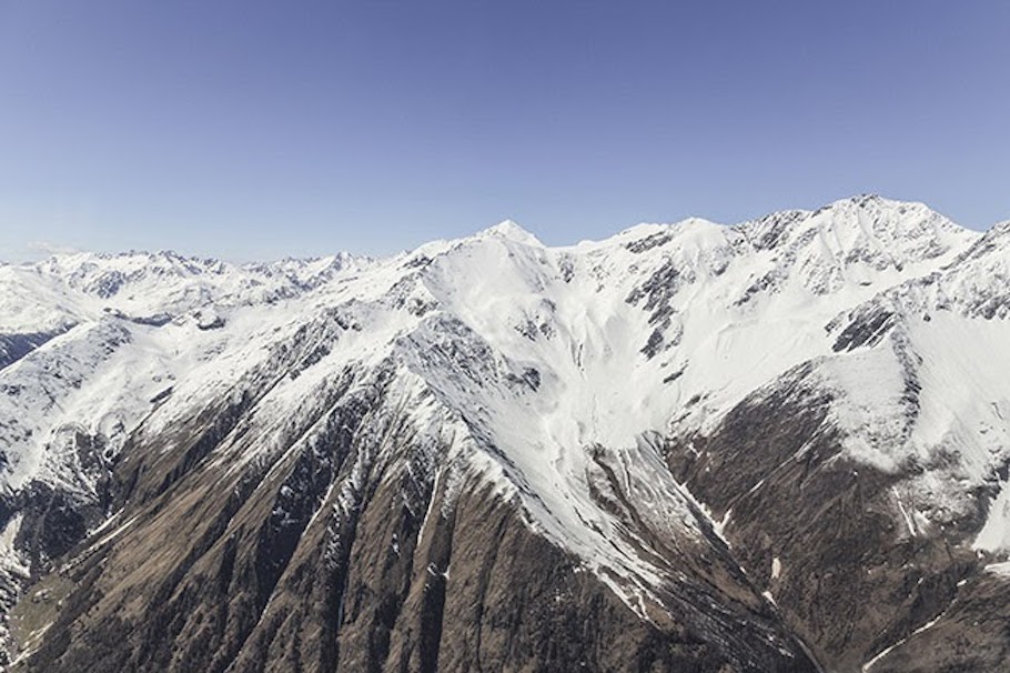
Through an immersive and interactive installation that connects an automated drawing machine in the Arsenale with a network of GPS sensors installed on an Alpine glacier at 3,300 metres above sea level, Italian Limes unveils the political dimension intrinsic to the problem of representing territory. The exhibition shows how natural frontiers are subject to the complexity of continuous ecological processes, depending on the technologies and norms we use to represent it. On May 4th, 2014, the Italian Limes team installed a network of solar-powered GPS units on the surface of the Similaun glacier, following a 1-km-long section of the border between Italy and Austria, in order to monitor the movements of the ice sheet throughout the duration of the exhibition at the Corderie dell’Arsenale.
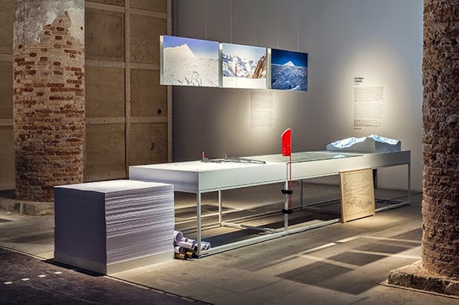
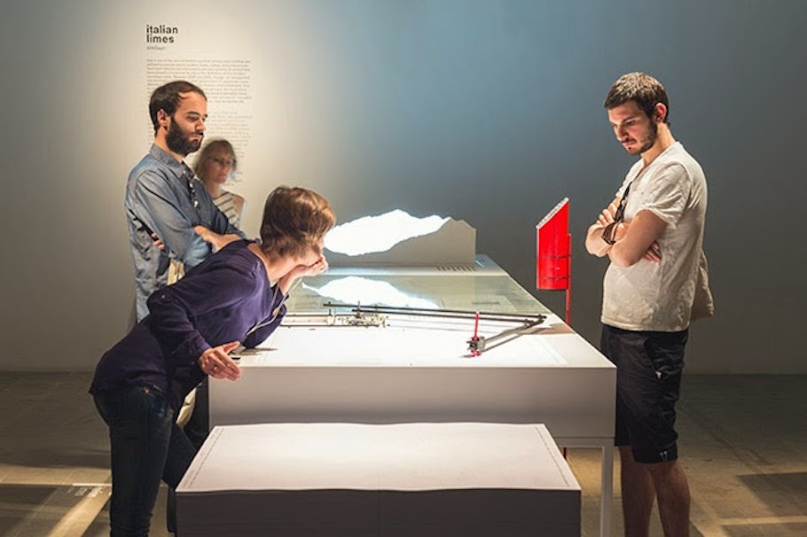
The geographic coordinates collected by the sensors are broadcasted and stored every hour on a remote server via a satellite connection. An automated drawing machine—controlled by an Arduino board and programmed with Processing—has been specifically designed to translated the coordinates received from the sensors into a real-time representation of the shifts in the border. The drawing machine operates automatically and can be activated on request by every visitor, who can collect a customized and unique map of the border between Italy and Austria, produced on the exact moment of his visit to the exhibition.
Displaying unreleased materials from the archives of Istituto Geografico Militare (Italian national mapping agency), Italian Limes reveals also how the Alps have been a constant laboratory for technological experimentation, and how the border is a compex system in evolution, whose physical manifestation coincides withthe terms of its representation.
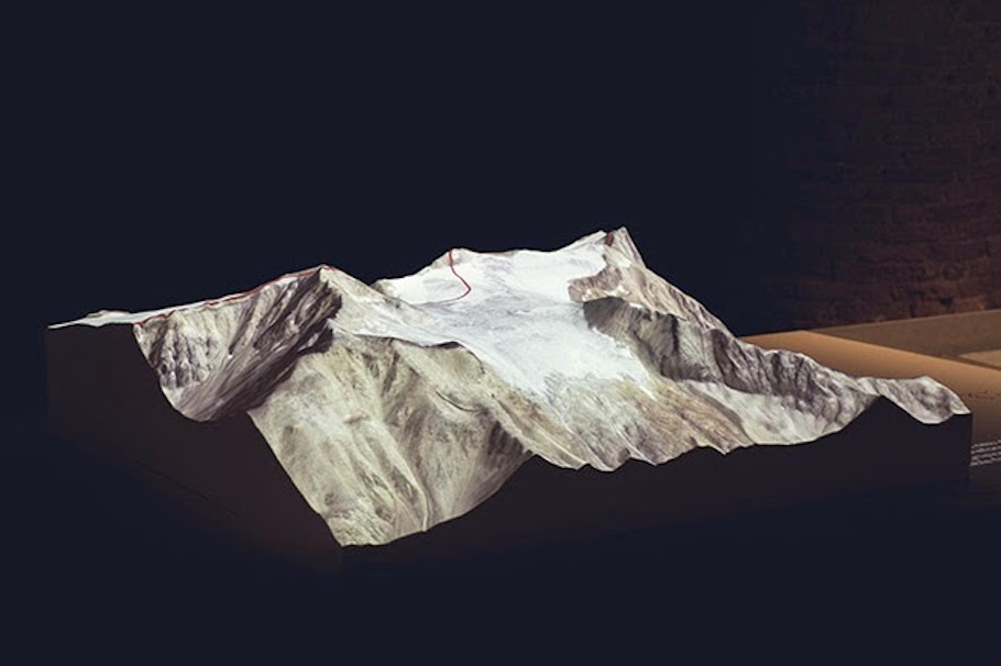
Finally, a raised-relief model of the Similaun peak and glacier in scale of 1:3,000 is the basis for a projection-mapped animation which shows the progressive transformation of the Italian–Austrian border’s geometry from 1920 to 2014.
More info at:
Italian Limes Website
Studio FOLDER